

Jvari Pass (Cross Pass) — opening hours, tickets, how to get there and what to see
Jvari Pass, also called the Cross Pass, is the highest point on the Georgian Military Highway at roughly 2,379 metres, in the Mtskheta-Mtianeti region near Gudauri. It has carried travellers between Tbilisi and the North Caucasus since antiquity, and the stone cross that gives it its name was erected in 1824 on the orders of Russian general Aleksey Yermolov. Today it is a short stop for drivers crossing to Kazbegi, with wide views of the main Caucasus range and, in winter, some of the highest avalanche risk on any paved road in Georgia.
What you see
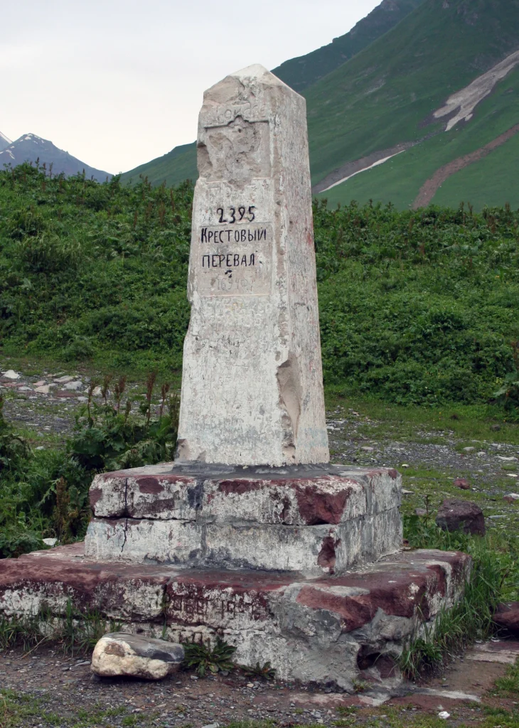
At the pass the road briefly flattens before dropping into the Devil’s Valley on the northern side. A stone cross stands on a rise beside the asphalt, a modern replacement for Yermolov’s original 1824 marker, and from the same spot the Greater Caucasus opens out in both directions: the Gudauri bowl and the Aragvi headwaters to the south, bare ridgelines and, on clear days, a first glimpse of Mount Kazbek to the north. Long concrete avalanche galleries cover sections of the road just below the pass, a reminder that this stretch of highway is closed by snow slides most winters. There are no buildings, cafes or facilities directly at the pass itself; it is a roadside viewpoint and photo stop rather than a destination with infrastructure.
History
The route over Jvari Pass has linked Georgia and the North Caucasus since at least the early medieval period, used by traders, armies and pilgrims long before any engineered road existed. The modern carriageway dates to the Russian Imperial period: construction of the Georgian Military Highway began in 1799 and the road was substantially rebuilt and widened through the 1850s and 1860s to carry military traffic between Vladikavkaz and Tbilisi. General Yermolov had a stone cross set up at the summit in 1824 to mark the crossing point, which gave the pass its Georgian and Russian names (Jvari, Krestovy). The road and its passengers later became literary subjects: Alexander Pushkin described the crossing in his 1829 travelogue “A Journey to Arzrum”, and Mikhail Lermontov set scenes of “A Hero of Our Time” along the same stretch. Soviet-era engineers added the avalanche galleries and retaining works that still protect the road below the pass. The route remains the only year-round land connection between Georgia and Russia through the Caucasus and is managed today as part of the national road network overseen by Georgia’s roads authority (georoad.gov.ge).
Opening hours and tickets
| Item | Detail |
|---|---|
| Access | Open year-round, weather permitting; no gate, no entry fee |
| Winter closures | Frequent short closures for snow clearance and avalanche control, sometimes several hours, occasionally a full day |
| Current status | Check before travelling, especially November to April — checked at booking |
There is no ticket and no fixed schedule. The pass is simply a point on a public road, so the only practical question is whether the Georgian Military Highway is open. Status updates for this road are posted by Georgia’s road authority (georoad.gov.ge); we also track conditions on our own road-status page before any trip that crosses the pass.
How to get there
From Tbilisi the pass is about two and a half to three hours by car or minivan, following the Georgian Military Highway north through Mtskheta, Ananuri and Gudauri before the final climb. Shared marshrutkas running from Tbilisi’s Didube station toward Stepantsminda (Kazbegi) pass directly over it, though drivers rarely stop there. From Gudauri itself the pass is a ten to fifteen minute drive further north. There is no rail option; the nearest railway stations are in Tbilisi. With us, the pass is included on the way north on our Kazbegi — Gergeti Trinity Church in a Day tour and the Kazbegi — 2-Day Mountain Journey, and it sits just beyond our Gudauri — Mountain Escape itinerary; a private car with driver from Tbilisi to Gudauri or on to Kazbegi can also be booked separately through our services.
How long and the best time
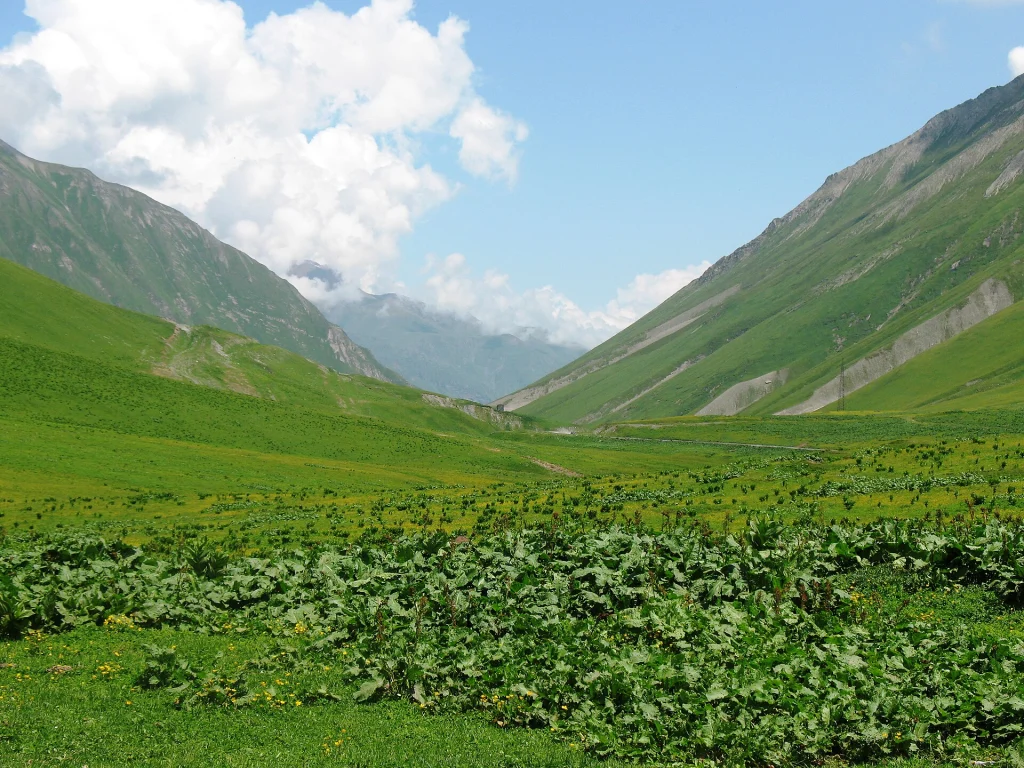
Most visitors spend ten to twenty minutes at the pass itself, enough for photographs and a look at the cross and the valley views, since it is normally a stop along a longer drive to or from Kazbegi. Late May to October gives the most reliable road conditions and the clearest mountain views. Winter visits are possible and dramatic, with snow-covered ridges on both sides, but closures are common and driving the approach requires caution or, better, a local driver experienced with the route.
Tips
- Dress warmer than the weather in Tbilisi suggests: the pass sits above 2,300 metres and wind is near-constant even in summer.
- The best photographs of the cross against the ridgeline come in early morning light, before haze builds up over the valley later in the day.
- Weather changes quickly; cloud can close in within minutes even on a clear forecast day, so do not plan the pass as the only scenic stop on a tight schedule.
- There are no toilets or shops at the pass; use facilities in Gudauri before continuing north.
- In winter, treat any planned crossing as provisional and have a backup plan in Gudauri if the road closes.
- Combine the stop with the Russia-Georgia Friendship Monument a short drive below the pass, which has a larger viewing area and is easier to park at.
Nearby
- Gudauri ski resort
- Russia-Georgia Friendship Monument
- Ananuri Fortress
- Stepantsminda and Gergeti Trinity Church
- Devil’s Valley viewpoint
Jvari Pass (Cross Pass) is on these private tours: New Year in Georgia — Tbilisi Fireworks, Kakheti Supra and Gudauri Snow, 6 Days · Georgian Military Highway — Ananuri, Gudauri and Gergeti in a Day · Georgia Classic in 7 Days — Tbilisi, Kazbegi, Kakheti and Mtskheta. A travel expert adapts any of them to your dates.
Questions
How high is Jvari Pass?
It sits at roughly 2,379 metres, the highest point on the Georgian Military Highway between Tbilisi and Kazbegi.
Is there an entrance fee?
No. It is a public road viewpoint with no ticket and no gate.
Can the pass close in winter?
Yes, snow and avalanche risk cause frequent short closures from roughly November to April; check road status before travelling.
Is Jvari Pass the same as the Friendship Monument?
No, they are close together but separate: the pass is the road summit with the stone cross, the monument is a mosaic viewpoint a short drive below it.
Sources
Iron cross monument marks the summit of the Jvari (Cross) Pass on the Georgian Military Road. · Photo: Draceane / Wikimedia Commons, CC BY-SA 4.0