

By Nino Gelashvili, Travel News Editor · 01/11/2026
The short answer: Tusheti, in Georgia’s northeast corner against the Dagestan border, is open to vehicles only from roughly June to early-to-mid October, and only by 4×4 across the Abano Pass, a dirt and scree road that climbs past 2,850 metres. Outside that window the pass is closed by snow and the region is reachable, if at all, on foot or skis by experienced mountaineers. Inside it, Omalo, Dartlo, Shenako and Diklo form one of the best-preserved medieval mountain landscapes in the Caucasus, with defensive stone towers, guesthouses run by families who return each summer, and a national park that protects some of Georgia’s last untouched high-altitude forest and alpine pasture.
This guide sets out what is fixed for 2026 (the terrain, the no-pork custom, the need for 4×4) and what you should verify closer to your dates, because road-opening and closing dates move with the snowpack and are announced, not scheduled. We give the official pages to check, a season-by-season plan, and the options we run ourselves, from a single long day to a six-day crossing into Khevsureti over the Atsunta Pass.
When the road is open: the Abano Pass season
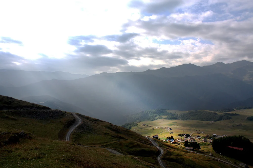
Tusheti’s only vehicle link to the rest of Georgia is the road over the Abano Pass (also written Abano or Abanos Tba pass), which connects Kvemo Alvani in Kakheti to Omalo. It is unpaved for most of its length, narrow, exposed to rockfall and landslide, and closed by snow for roughly eight months of the year. In most recent years it has opened between late May and mid-June and closed between late September and mid-October, but the exact dates depend on that winter’s snowfall and are set by the road authorities once the pass is physically clear and safe, not by a fixed calendar date.
- Do not plan a Tusheti trip for before 10 June or after 5 October without checking current conditions first.
- The Georgian Road Department publishes closures and condition updates for mountain roads, including Abano, and is the first place to check in the weeks before you travel: georoad.gov.ge.
- We track the pass daily in season and post a plain-language yes/no on our own road-status page before every departure.
- Even within the open season, a single heavy rainstorm can close the road for a day or two for debris clearance; build one buffer day into any Tusheti itinerary if you can.
The Abano Pass: what the drive is actually like
From Kvemo Alvani the road climbs through forest, then hairpins above the tree line with drops that are genuinely frightening to first-time passengers, before crossing the pass and descending into the Tusheti basin. The distance is around 70 kilometres and takes four to five hours each way in a capable 4×4 with an experienced local driver; it is not a drive to attempt in an ordinary rental sedan, in a minivan, or without local knowledge, whatever the weather looks like at the bottom. Mobile signal disappears for long stretches. Self-drive is technically possible but strongly discouraged for visitors without serious off-road experience and a vehicle built for it; most travellers, Georgian and foreign alike, go with a driver who does the route all season.
We run the crossing as part of several itineraries, including Tusheti by 4×4 — Omalo, Dartlo and Diklo in 3 Days and the longer 4×4 Expedition — Tusheti, Khevsureti and Kazbegi in 8 Days, both with drivers who know the pass’s daily moods.
Omalo and the Keselo towers
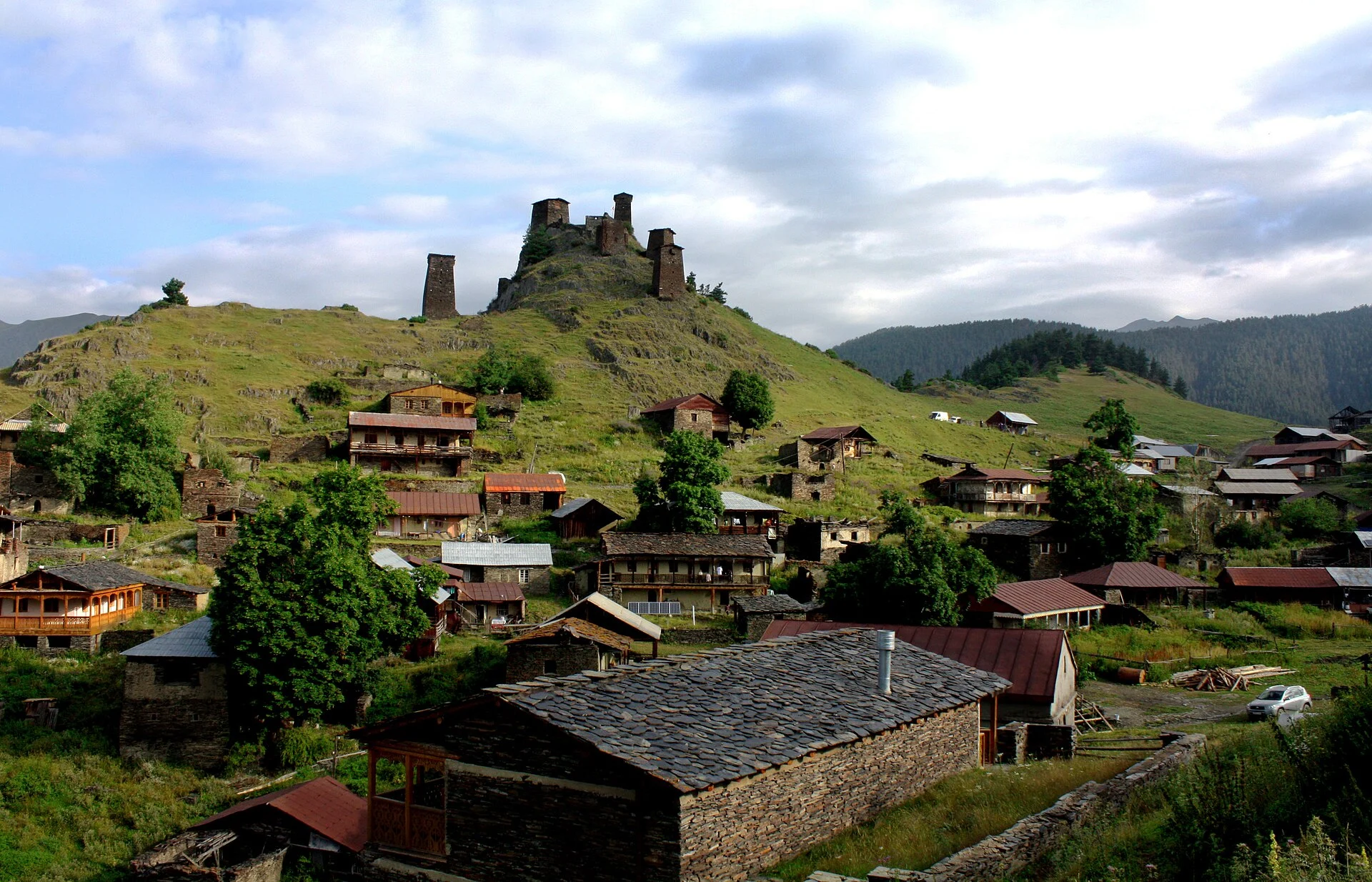
Omalo is the administrative centre of Tusheti and the usual base, really two settlements: lower Omalo, where most guesthouses and the small shop sit, and upper Omalo (Kedo), a cluster of stone defensive towers on a ridge above, known collectively as Keselo. The towers, some dating to the medieval period, were built for refuge during raids and are the single most photographed sight in the region; a short, steep walk up from lower Omalo reaches them in twenty to thirty minutes, with views over the whole upper valley and, on a clear day, toward the Dagestan ridgeline. There is a small site fee and basic signage; the towers are not heavily restored, which is part of the appeal and part of why visitors should not climb on unstable sections.
Dartlo, Shenako and Diklo
| Village | Distance from Omalo | Why go |
|---|---|---|
| Dartlo | About 10 km, 20–30 minutes by 4×4 | The best-preserved tower village in Tusheti, slate roofs, a working ethnographic feel, several guesthouses |
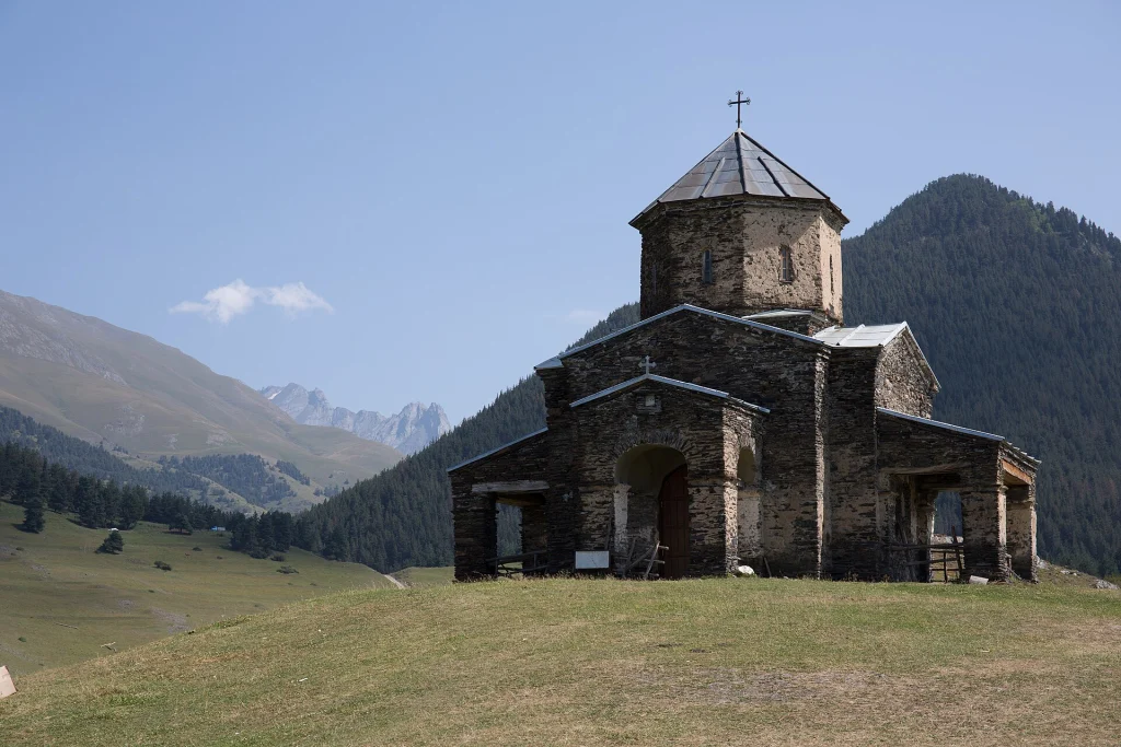
| Shenako | About 7 km | A small domed church, wooden balconies, quieter than Dartlo, good base for short walks |
| Diklo | About 20 km, rougher track | The furthest village commonly visited, close to the Dagestan border, dramatic ridge-top position, fewer tourists |
Dartlo in particular is worth at least a half day on foot rather than a drive-through stop; its towers and granaries are still used by Tush families who return in summer to herd sheep on the high pastures, and the walking trail between Dartlo and Chesho or on to Parsma adds more tower hamlets with almost no other visitors. Diklo’s road is the roughest of the three and in wet weather may not be passable in every vehicle; ask your driver or guesthouse host before setting out.
Tusheti National Park, hiking and horse treks
Tusheti National Park and the surrounding protected landscape cover the high valleys around Omalo and are managed by Georgia’s Agency of Protected Areas, which maintains marked trails, basic ranger points and camping guidance; check current trail status and any permit requirements before a multi-day hike at apa.gov.ge. The park protects birch and pine forest, alpine meadow, and habitat for chamois, brown bear and a healthy population of birds of prey; it is also one of the last refuges of the East Caucasian tur, a wild goat endemic to these mountains.
- Day walks: Omalo to Dartlo, Dartlo to Parsma, Shenako to Diklo, all manageable without a guide if you carry a map and water.
- Horse treks: locally organised rides are the traditional way to reach the higher pastures and more remote villages; arrange through your guesthouse host, who will know which families keep horses that season.
- The multi-day route to Khevsureti over the Atsunta Pass (around 3,400 metres) is a serious high-mountain trek, snow-free only in high summer, and should be done with a guide who knows current conditions; we run it as Tusheti to Khevsureti — Omalo to Shatili over the Atsunta Pass, 6 Days.
- Weather in the high valleys changes fast; afternoon storms are common in July and August, and nights are cold even in summer.
Guesthouses, the no-pork rule and Atengenoba
There are no hotels in the resort sense in Tusheti; accommodation is almost entirely family guesthouses in Omalo, Dartlo, Shenako and a handful of other villages, offering a bed and home-cooked meals, usually booked through the host directly, through a driver who knows the family, or through a tour operator. Rooms are simple, bathrooms are often shared, and electricity can be limited to solar or generator hours, which is part of what makes the region feel genuinely remote rather than remote-themed.
One custom matters more than any other for visitors: pork is traditionally not eaten, cooked or brought into Tusheti, a rule tied to the region’s historical reliance on pig-free livestock herding and still widely respected in guesthouses and at communal meals. Do not bring pork products as gifts or picnic food, and expect menus built around lamb, mutton, local cheese, khinkali and guda cheese rather than pork-based dishes found elsewhere in Georgia.
Atengenoba is the main Tush festival, held in villages across the region in late July, with dates varying by village and set by local religious-communal calendars rather than a fixed national date; it involves processions to a shrine, communal feasting and, in some villages, restrictions on women’s participation in certain rites, which visitors should observe respectfully and ask locally about before attending. If your dates might overlap with a village’s Atengenoba, ask your guesthouse host or guide in advance, since it affects both what you will see and how a village should be approached that day.
Planning your visit: how to actually get there
Most visitors reach Tusheti on an organised multi-day trip from Tbilisi or Kakheti, since the drive alone takes most of a day each way and self-arranged logistics (vehicle, driver, guesthouse bookings) are easiest handled together. We run the region at several paces:
- Tusheti by 4×4 — Omalo, Dartlo and Diklo in 3 Days, for a focused first look at the towers and villages.
- Tusheti — Georgia’s Last Wild Frontier (4 Days), with more walking time around Dartlo and Shenako.
- Tusheti Photography Expedition — 5 Days, timed around early and late light at Keselo and Dartlo.
- Khevsureti and Tusheti by 4×4 — 5 Days and the Caucasus Highlands in 7 Days, for combining Tusheti with Kazbegi and Khevsureti in one trip.
- Tusheti to Khevsureti — Omalo to Shatili over the Atsunta Pass, 6 Days, for the full high-mountain crossing on foot.
- The 4×4 Expedition — Tusheti, Khevsureti and Kazbegi in 8 Days, for travellers with limited time who want all three mountain regions in one booking.
For current entry rules, border-zone permits near Diklo and Dagestan, and general travel advice for Georgia, check your government’s travel advisory and Georgia’s own foreign ministry page at mfa.gov.ge; Tusheti borders Russia and parts of the northern valleys near Diklo can fall within a border security zone where identification should always be carried.
If this guide is part of a trip you are planning, our Caucasus Highlands in 7 Days — Kazbegi, Khevsureti and Tusheti and Tusheti Photography Expedition — 5 Days cover the places it describes with a private guide and driver; a GTour travel expert adapts the route to your dates.
Practical summary
- Road open roughly June to early/mid-October only, weather-dependent; confirm current status at georoad.gov.ge or on our road-status page before travelling.
- 4×4 with an experienced local driver only, never a standard car or an untested self-drive attempt.
- Allow four to five hours each way for the Abano Pass crossing; build in a buffer day in case of closure.
- Base in Omalo, day-trip or overnight in Dartlo, Shenako and (road permitting) Diklo.
- Book guesthouses through a host or operator in advance in July and August, the busiest weeks.
- Do not bring or expect pork dishes anywhere in Tusheti.
- Ask locally before approaching an Atengenoba festival; dates vary by village, usually late July.
- Carry ID at all times near Diklo and the northern border villages.
- Mountain weather changes fast even in summer; pack layers and rain protection regardless of the forecast at the bottom of the pass.
Sources
- Tusheti Protected Areas
- Road conditions and closures, Georgian Road Department
- Travel advice for Georgia, Ministry of Foreign Affairs
- Tusheti – Lonely Planet guide
- "The remote region of Georgia few outsiders have seen" – Smithsonian Magazine
Questions this guide does not answer? Write to info@castle.ge or WhatsApp +995 577 41 63 14 — a person in Tbilisi replies. See also our travel services and all guides.
Upper Omalo village with its ancient stone defensive towers, the main hub of Tusheti. · Photo: Abramia Giorgi / Wikimedia Commons, CC BY-SA 4.0
Been to Georgia? Tell us how it went — the best stories are published here.
Share your tripOne email a week: what changed for travellers in Georgia — rules, roads, flights, seasons — plus one place worth the trip. Written by the GTour desk, no advertising, unsubscribe in one click.
This story across our partner network — ქართულად: შენი დასვენება
